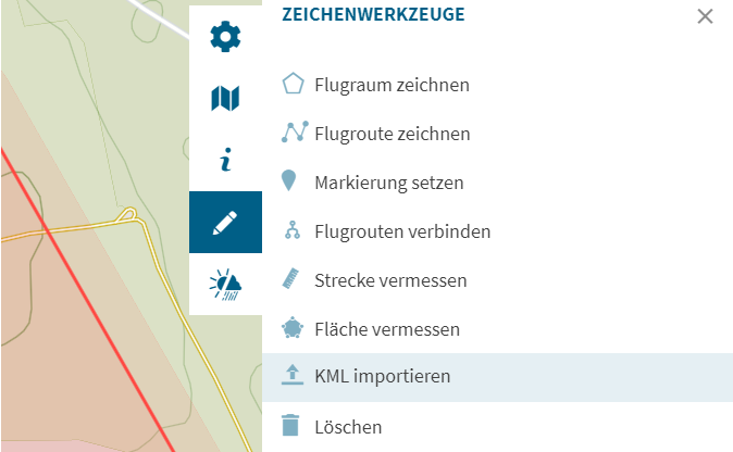
Kein Nachzeichnen oder einzelne Eingabe von Koordinaten mehr! Seit neuestem gibt es die Möglichkeit KML-Dateien zu importieren. Die neue Import-Funktion von Wegpunkten und Flugrouten als KML-Datei steht ab sofort allen Nutzern der FlyNex Enterprise Suite und Map2Fly Pro zur Verfügung. Damit lassen sich Koordinaten beispielsweise aus Google Earth in die Map2Fly übertragen.
Wie importiere ich KML-Dateien in Map2Fly?
Um KML-Dateien in die Map2Fly zu importieren, brauchen Sie mindestens die Pro-Version der Anwendung. Legen Sie ein Projekt an und öffnen Sie im rechten Menü die Zeichenwerkzeuge. Dort finden Sie die Option „KML importieren“. Es öffnet sich ein Fenster. Wählen Sie die gewünschte KML-Datei und laden Sie sie hoch. Jetzt befinden sich die Koordinaten Ihrer KML-Datei auf der Map2Fly-Karte in Ihrem Projekt.

Was ist KML?
Keyhole Markup Language, abgekürzt KML, ist eine Auszeichnungssprache für Geodaten. Vereinfacht erklärt wird z. B. eine oder mehrer Koordinaten nicht auf einer Landkarte dargestellt, sondern in Form einer text-basierten Daten gespeichert. Dieses Datei-Format lässt sich durch seine geringe Größe leichter speichern und übertragen und kann Geodaten in Vektor- wie auch in Rasterform beinhalten.
Andere Karten- oder Navigationsoberflächen können Informationen aus der KML-Datei dann wiederum auf einer Karte darstellen. Bekannt wurde es durch Google Earth, wo KML-Dateien erstellt wurden.


