Projekt DaViLuS
Datenvisualisierung von Luftraumstruktur

Zusammenfassung
Der Deutsche Drohnen-Luftraum als 3D-Karte
Die sichere und wirtschaftliche Integration von UAS in den Luftraum ist national wie international omnipräsent, jedoch unter Datenverarbeitungs- und –visualisierungsaspekten nur wenig beleuchtet. Die für den unteren Luftraum zu schaffenden Infrastrukturen werden dabei anders als in der bisherigen Luftfahrt maßgeblich durch bodengebunden Infrastruktur bestimmt. Diese Infrastruktur am Boden führt aufgrund geltender Gesetze und der Objektbeschaffenheit zur Bildung neuer Lufträume in einer sehr differenzierten Art und einer großen Anzahl.
DaViLuS zielt darauf ab, eine technische Lösung zu entwickeln, welche die notwendige Luftrauminfrastruktur anhand der Gesetzeslage auf Basis der umfassenden Geodatenlage abbildet und für Behörden, Unternehmen und Verbraucher verständlich in 3D visualisiert. Außerdem sollen empirisch die Akzeptanzkriterien und die Nutzerfahrung für die geschaffenen und visualisierten Lufträume geprüft werden. FlyNex validiert die umfassende aktuelle Datenlage inklusive der Metadaten speziell für die unbemannte Luftfahrt und analysiert die Geodaten vor dem Hintergrund der Verwendbarkeit und Relevanz für die unbemannte Luftfahrt. Die Luftrauminfrastruktur wird als Ergebnis referenziert in 3D abgebildet und veröffentlicht.
Dazu arbeitet das Konsortium mit der Firma HERE und zahlreichen Behörden eng zusammen. Das Institut für unbemannte Systeme der Northern Business School wird die kreierten Lufträume hinsichtlich Akzeptanzkriterien empirisch prüfen und die Nutzererfahrung anhand der Visualisierung evaluieren. Das Projekt-Ergebnis ist zu finden unter https://davilus.flynex.de/
Zahlen & Fakten
- Knapp 360.000 km² Luftraum (357.386 km²) wurde digital visualisiert
- Gesamte Umsetzung des Projektes in weniger als einem Jahr
- KI-gestützter Routing-Algorhitmus zur automatischen 3D-Berechnung
- Mehr als 165 validierte Datenquellen für Geo- und Raum-Informationen
- Zusätzlich 34 UAS-Gebietslayer in 2D und 3D
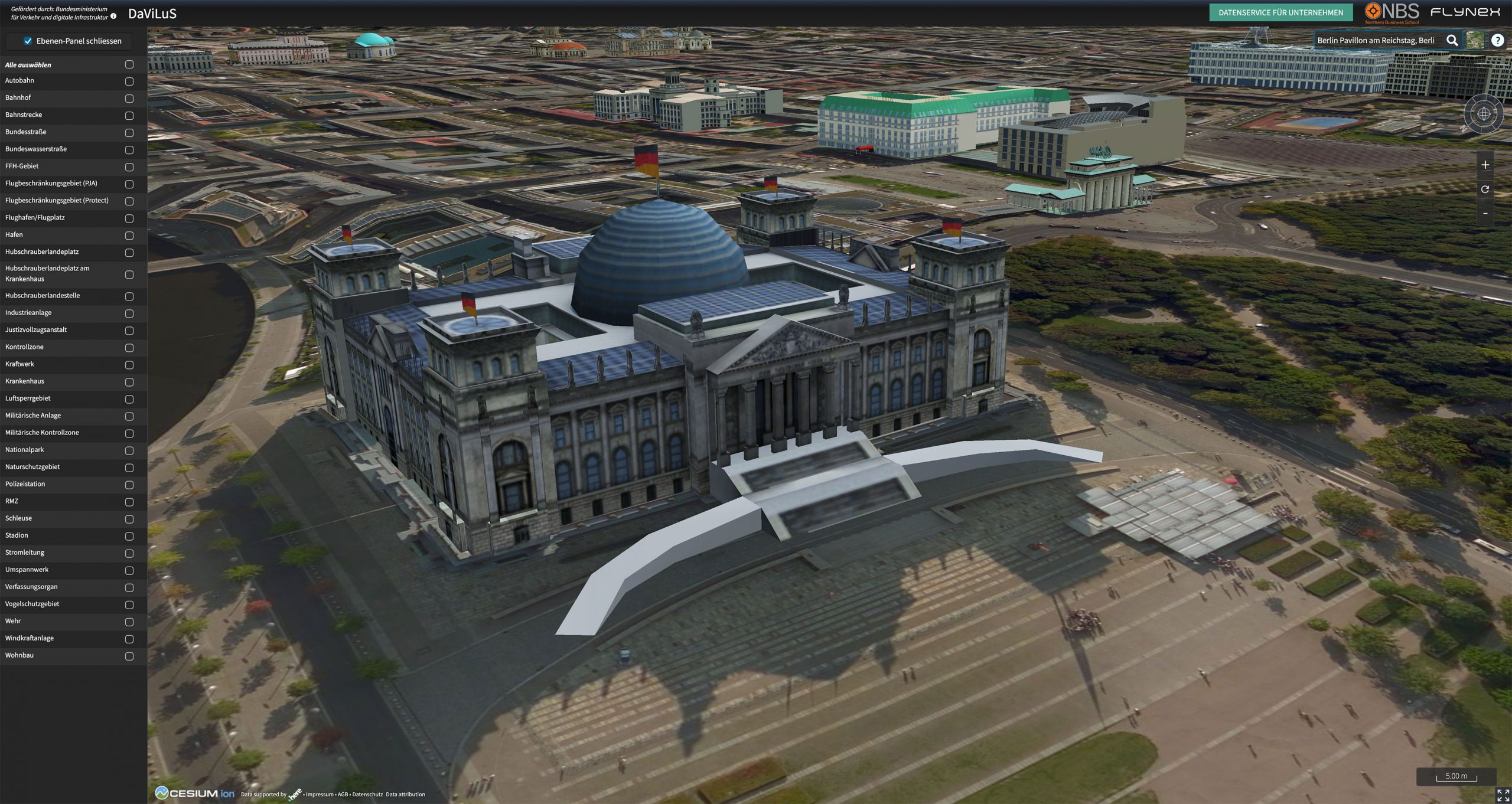
- Texturierte 3D-Gebäudemodelle, wie der Kölner Dom oder das Reichstagsgebäude in Berlin
2D Routing-Algorithmus zur Navigation durch den Luftraum. In Vorbereitung auf UTM, 3D-Karten und Luftraum-Navigationsdienste.


